

The world’s first study of the increase in pollution from landscape fires across the globe over the past two decades revealed that over 2 billion people are exposed to at least one day of potentially health-impacting environmental hazard annually – a figure that has increased by 6.8% in the last ten years.
The Australian led study, published 20 September in Nature, highlighted the severity and scale of the landscape fire-sourced air pollution, its increased impact on the world’s population and associated rise in public health risk.
The team, from Monash University’s School of Population Health and Preventive Medicine, estimated the global daily air pollution from all fires from 2000 to 2019 and in addition to that one day of significant contact, each person in the world had on average 9.9 days of exposure per year, an increase of 2.1% over the last decade.
It also found that exposure levels in low-income countries were about four-fold higher than in high income countries, with a resulting increase in many adverse health impacts, including increased mortality and morbidity and a global worsening of cardiorespiratory conditions and mental health.
Co-authors, Professors Yuming Guo and Shanshan Li, noted that their previous studies had estimated the daily fire-sourced PM2.5 for Brazil and 749 worldwide locations during the period 2000–2016.
“Many studies also estimated fire-related PM2.5 in the US and Europe using various approaches such as chemical transport models, satellite-based fire smoke plume, machine learning,” they said.
“However, there was still a lack of data in many other regions, particularly sub-Saharan Africa, and Southeast Asia where landscape fires are frequent. Our results showed that exposure levels of PM2.5 were particularly high in Central Africa, Southeast Asia, South America, and Siberia.”
The study also looked at global landscape fire-sourced ozone, an important fire-related pollutant that had only been estimated for US prior to the recent Canadian wildfires that spread smoke across North America, which highlighted the increase in severity and frequency of landscape fires due to climate change.
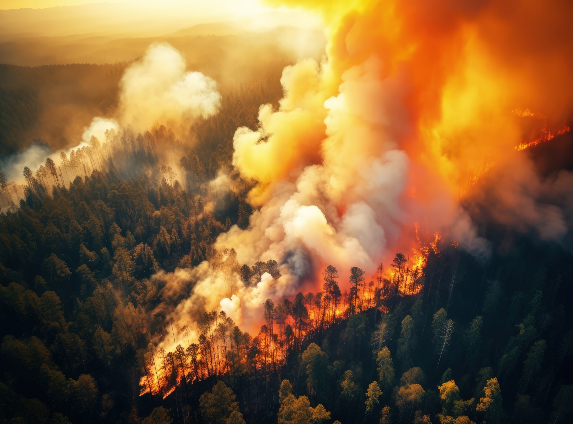
Landscape fires refer to any burning in natural and cultural landscapes, such as natural and planted forest, shrub, grass, pastures, agricultural lands, and peri-urban areas, including both planned or controlled fires (e.g., prescribed burns, agricultural fires) and wildfires (defined as uncontrolled or unplanned fires burning in wildland vegetation).
The comprehensive assessment of the global population exposures to fire-sourced PM2.5 and ozone during 2000-2019 was calculated using a machine learning approach with inputs from chemical transport models, ground-based monitoring stations, and gridded weather data.
According to Professor Guo, no study to date has looked at the long-range effect of this increase in landscape fires globally and wildfires often impact remote areas where there are few or no air quality monitoring stations. In addition, in many low-income countries, there are no air quality monitoring stations even in urban areas.
“The exposure to air pollution caused by landscape fire smoke travelling hundreds and sometimes even thousands of kilometres can affect much larger populations, and cause much larger public health risks,” he said.
“Mapping and tracking the population exposure to landscape fire-sourced air pollution are essential for monitoring and managing its health impacts, implementing targeted prevention and interventions, and strengthening arguments for mitigation of climate change.”
The findings are significant for Australia, given that the recent 2019/2020 bushfires were unprecedented in their size and intensity, resulting in a catastrophic loss of habitat and human and animal life across eastern-Australia.
By burned area the bushfires were the largest in south-east Australia since European occupation in the late 1700s, burning more than 10 million hectares of vegetation. The burned area of the 2019/2020 fires was larger than the Ash Wednesday (1983) and Black Saturday (2009) fires combined.
The immediate impacts of the bushfires included the destruction of almost 6,000 buildings and the deaths of 34 people and more than 3 billion terrestrial vertebrates, and climate change is projected to increase the frequency, intensity and spread of wildfires both globally and in Australia.
Fire weather conditions in Australia are predicted to worsen, with forest fire danger index (FFDI) projected to increase in all climate change scenarios (0%–30% by 2050). Alongside this, the number of days where fire danger is ‘very high’ or ‘extreme’ is projected to increase, with an associated increase in the length of the fire season.
Previous studies investigating the impact of these fires found that between September and February an additional ∼437,000 people were exposed to “Poor” or worse air quality index levels due to the fires across eastern-Australia, with estimates indicating that between October and February, 171 deaths were brought forward due to exposure to PM2.5 from the fires.
Regionally, most deaths were brought forward in New South Wales (109 deaths brought forward), Queensland (15), and Victoria (35). Within these regions, the most deaths were brought forward in Sydney (65), Melbourne (23), and Canberra-Queanbeyan (9) as large populations were exposed to high PM2.5 concentrations due to the bushfires.